Ellipsoid
Advertisement
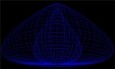
Inertial Oscillation Model v.1.0
Study particle movement with this simulation. Inertial Oscillation model displays the motion of a particle moving over the surface of an oblate spheroid. The spheroid is flattened to an ellipsoid of revolution because it is rotating,
Advertisement
MVE for JAVA v.1.0
Minimum Volume Ellipsoid Estimation. MVE for JAVA is an advanced utility designed for multivariate estimation. Usage of the software is free, but citation is appreciated.This method is used for robust outlier detection in multivariate space.
TOPOWIN v.16.00
TOPOWIN is a state-wide register of the German topographic cartographies and of localities with geo references in different coordinate systems. It also is a topographic information system.

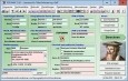
ORTWIN v.13.02
ORTWIN is a program for the inquiry of localities in Germany. It finds postal zip codes, telephone pre selections, coordinates. It performs perimeter searches and distance calculations. It finds landscapes, natural units, snow- and wind load zones.
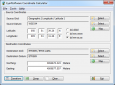
Eye4Software Coordinate Calculator v.3.2.12.208
Eye4Software Coordinate Calculator is a very easy to use tool to perform gps coordinate conversions. Supported projections: Transverse Mercator, Lambert Conformal Conic, UTM, Gauss Kruger, Stereographic, Albers Equal Area, Oblique Mercator and more.
Datasqueeze v.2. 1. 2003
Datasqueeze is a graphical interface for analyzing data from 2D x-ray diffraction detectors (wire, image plate, CCD), running on Windows, Linux, and Macintosh OS X.
Geoida v.1.0
Geoida is a software product that will benefit members of the surveying and related professions for the day-to-day routine processing, coordination and adjustment of spatial survey data, from routine pick-up surveys to complex networks of geodetic sc

SEVENPAR (Deutsch) v.1 4
The program produces a set with seven parameters of the sapatial Helmert transformation valid for an specific area, with which then arbitrary coordinates of the area can be transformed from one reference system into another with high accuracy.
ThreeDify Designer v.5.3.3
ThreeDify Designer is a 3D modeling, viewing, and markup software that makes 3D and 3D CAD visualization easy and affordable. ThreeDify Designer features an intuitive GUI and native import support for over 40 3D file formats.
UTM converter v.1.1
UTM converter is a simple tool to convert Lat/Long to UTM, allows you to convert between decimal Latitude/Longitude and UTM. It has a very simple interface that will quickly guide you through all its options. UTM converter Features: 1. The ordering
GreatCirc v.2.1
GreatCirc is a software for calculating Great Circle distances on the earth's surface, and plotting points and outstanding circle paths on a world map.Basic Features 1. Great Circle Distance calculation: find the shortest distance and direction